
Parker Ridge © Parks Canada / Dani Lefrançois
Icefields Parkway
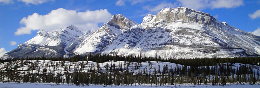
Banff National Park
The Icefields Parkway (Highway 93 North) joins the hamlet of Lake Louise in Banff National Park with the Town of Jasper in Jasper National Park. Give yourself a full day to travel one-way. It is one of the most scenic highways in the world.
Points of interest
Looking for a view from the edge?
Toe of the Athabasca Glacier Trail © Parks Canada

Check out these roadside attractions:
- Herbert Lake A photographer’s favourite. The still waters of Herbert Lake provide a perfect panoramic reflection of the stunning Main Range peaks, including Mount Temple. The picnic area provides an ideal place for a picnic stop. Google Street View
- Crowfoot Glacier When this glacier was named a century ago, it looked like a three-toed crowsfoot. Since then, one toe has melted, and the middle toe is slowly disappearing. Google Street View
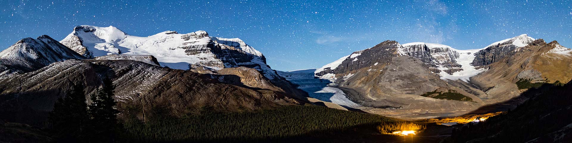
- Athabasca Glacier A magical area that can be seen from the road, explored with a commercial guide or visited on a special bus tour. Do not walk on the glacier; crevasses and other hazards can be deadly. Google Street View
Need to stretch your legs?
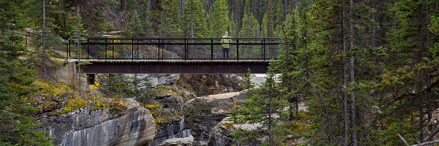
Mistaya Canyon © Parks Canada
Try one of these short strolls:
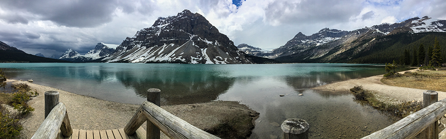
- Bow Lake and Bow Glacier The source of the Bow River, Bow Lake is one of the more scenic and accessible lakes for fishing. Google Street View
- Mistaya Canyon A brief, relatively steep descent leads to a footbridge traversing the zig-zag curves of Mistaya Canyon and a powerful river below. Google Street View
- Sunwapta Falls A torrent of plunging water not far from the highway, Sunwapta Falls are just one of the many waterfalls in Jasper created by hanging valleys. Google Street View
- Athabasca Falls Feel the spray of the Athabasca River as it thunders into the canyon below. Stay behind railings and on designated trails. The rock beyond is slippery and dangerous. Google Street View
Looking for adventure?
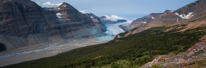
Athabasca Glacier from Wilcox Pass © Parks Canada
Step into the wild with one of these classic day hikes:
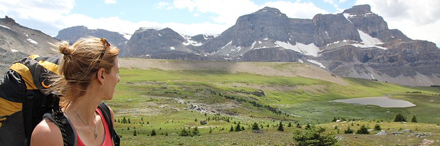
- Helen Lake 6.0 km one way; 455 m elevation gain; 4 to 5 hr round trip Trailhead: across from Crowfoot Glacier Viewpoint. A breathtaking lake in a valley abounding with alpine wildlife and grand vistas.
- Parker Ridge 5.4 km return; 250 m elevation gain/loss; 3 hr round trip Trailhead: 9 km south of the Icefield Centre. After a series of switchbacks you’ll be rewarded with dramatic views of the Saskatchewan Glacier.
- Wilcox Pass 2.4 km (1 hr) return to first viewpoint, 8 km (2-3 hrs) return to the pass. Trailhead: 3 km south of Icefield Centre at Wilcox Campground. Rise quickly above treeline to the expansive meadows of this glacier-carved landscape.
- Valley of the Five Lakes 4.5 km loop; 66 m elevation gain/loss; 2 hours Trailhead: 9 km south from Jasper on Highway 93. Five small, brilliantly blue-green lakes are the highlights of this outing, considered a local family favourite.
Looking for backcountry information?
 '
'
Refer to Jasper National Park Backountry camping or Banff National Park Backcountry camping
Time for lunch?
Bow Lake © Parks Canada
Visit a scenic picnic site:
- Bow Lake Enjoy your lunch at one of the most breathtaking lakes in the Rockies. A vibrant blue colour set against a magnificent mountain backdrop.
- Coleman Creek Sit next to the edge of the water and listen to the relaxing gurgle of the river. Look for mountain goats on the cliffs.
The Columbia Icefield
About the Icefield
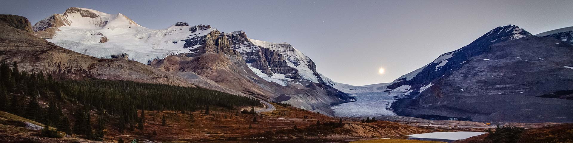
Athabasca Glacier and Columbia Icefield Discovery Centre © Parks Canada
With a total area of 200 km2, the Columbia Icefield is the largest mass of glacial ice in the Canadian Rockies. It feeds several large glaciers, including the Athabasca, the Columbia and the Saskatchewan.
What’s a glacier? Glaciers form where more snow falls in winter than melts each summer. As the snow gets thicker and heavier, it compacts into dense glacial ice that slowly flows downhill, like a river of taffy.
Glacier and rivers Water flows to three different oceans from the Columbia Icefield, known as a hydrological apex. On the British Columbia side, melt water flows into the Columbia River and the Pacific Ocean. On the Alberta side, the North Saskatchewan and Athabasca rivers feed into the Atlantic and Arctic Oceans, respectively. These rivers provide fresh drinking water for millions of people, and are crucial to agriculture and countless ecosystems. That’s why their source is protected in a national park.
Accommodation
Where to stay on the Icefields Parkway
Silverhorn Creek Campground in Banff National Park © Parks Canada
A variety of accommodation is available on the Icefields Parkway.
- Explore your hotel options through Banff Lake Louise Tourism or Tourism Jasper
- There five year-round Hostelling International (HI) wilderness hostels on the Icefields Parkway.
- There are eleven seasonal campgrounds on the Icefields Parkway:
Know before you go
Services and amenities
Bow Lake © Parks Canada
The Icefields Parkway (Highway 93 North) runs north-south between Lake Louise, Alberta (Highway 1 Junction) and Jasper, Alberta (Highway 16 Junction) for 232 km (144 miles).
Services and amenities: Services are only available from June through September and include four hotels with dining, gifts and souvenirs. Most day use areas have dry toilets. There is one gas station in 232 km. Bring refreshments and fill up before you depart.
Cell coverage: There is no cell coverage on the Icefields Parkway.
Roads and weather
Mount Wilson in May © Parks Canada
Seasons: Winter is long on the Icefields Parkway, turning the lakes white and covering trails in deep snow until mid-June. Lakes melt into blue-green hues by late June and alpine hiking trails are mostly snow-free by mid-July. In June, July and August, expect daytime highs of 17° to 20° C and overnight lows of 2° to 3° C. Rain can fall as snow any month of the year on the Icefields Parkway.
Roads and weather: From October through May there is no road maintenance from 3:30 pm to 7 am and no gasoline. Winter tires are required and the road may close without warning. During the summer, snow is infrequent but not unusual. Overnight temperatures near freezing are common year-round. Check the road report (Call 511 in Alberta) and weather forecast before departing.
Footwear and clothing: Viewpoints may be muddy or have uneven surfaces, and temperatures can be cool year-round. For your comfort and convenience, we recommend wearing sturdy footwear and bringing extra layers of clothing.
Wildlife
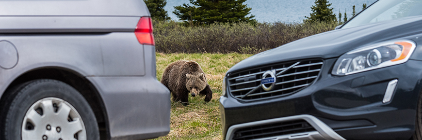
Grizzly bear at Bow Lake © Parks Canada / A. Taylor
Bears, sheep, wolves and even elusive caribou are often spotted on the roadsides – keep your eyes open and drive slowly, especially early morning and evening. If you stop to observe wildlife, for their safety and yours, pull well out of the driving lane onto the shoulder and stay inside your vehicle. Please give large animals 30 m or three bus lengths, and bears 100 m or ten bus lengths. Never feed or approach wildlife.
Park passes
Mistaya Canyon Parking Lot © Parks Canada
A valid national parks pass is required to drive the Icefields Parkway. Revenues from pass sales support maintenance, plowing, sanding and avalanche control. Consider purchasing a Discovery Pass for unlimited access to many of Canada’s extraordinary treasures.
Overweight vehicles
All recreational vehicles and buses are permitted on the Icefields Parkway. Restrictions apply on others:
- All other vehicles, including commercial vehicles and U-Hauls, must weigh less than 4550 kg (10,031 lbs) fully loaded. Check the TARE (empty weight) on your vehicle registration for guidance.
- Overweight commercial vehicles (greater than 4550 kg / 10,031 lbs) servicing businesses on the Icefields Parkway may obtain a permit in advance. Contact Realty Services for more information.
- All other overweight vehicles, including commercial moving trucks and transport trucks, are prohibited. Thank you for your patience and cooperation!
Map
Icefields Parkway Map


Related links
- Date modified :