
Park map
Waterton Lakes National Park
Discover locations and available services: roads, hiking trails, campgrounds, day use areas, and more.
The map shows the location, status and level of difficulty (easy, moderate, difficult) of each hiking trail in the park. It shows where Parks Canada services and facilities, campgrounds and day use areas are located. The map illustrates highways and roads and any other closed or restricted areas within the national park.Map of Waterton Lakes National Park
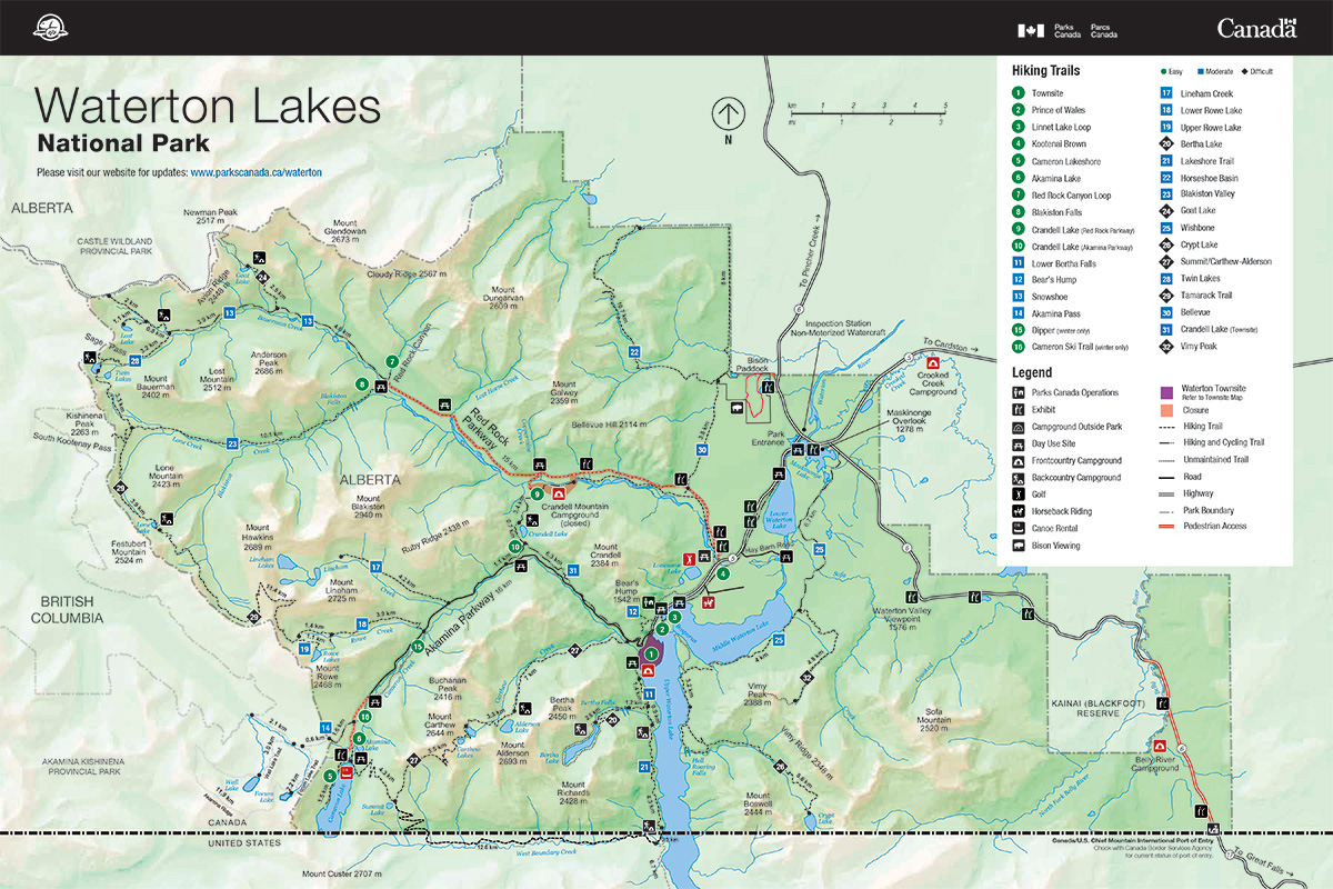
Park map - Text description
Related links
- Date modified :